Pulau Paya lies 6.5 miles E from Pulau Segantang, 88m high, is densely wooded and steepto, except for part of the NE side. The Pulau Paya Marine Park has been established and special regulations may apply. Pulau Lembu, 73m high, lies 0.5 mile NE of Pulau Paya. A rock awash lies ...
The Sungai Merbok (Merbau River), the entrance to which is formed between the low coast on the N and the hills to the S, is fronted by the coast mud flat, which has depths under 5.5m, and extends nearly 3 miles to seaward. There is a depth of 2m on the bar, with depths of 5m within. ...
From the Sungai Kedah the coast, with an adjoining mud flat, extends in a S direction for a distance of about 26 miles to the entrance of the Sungai Merbok (Merbau River), and continues low and wooded until within 8 or 9 miles of that river, where the conspicuous Gunong Jerai, 1,212m ...
The Sungai Muda is located about 6 miles S of the Sungai Merbok entrance. It is obstructed by a sandy bar which dries from 0.6 to 1.2m at LW. Small craft, drawing 1m, can enter at half tide and proceed about 4 miles upstream.
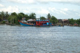
The Junk Anchorage, just south of the Tanjong City Marina, lies off the
clan jetties (the New, Yeoh, Lee, Tan, Chew and Lim jetties). Diesel
fuel is usually available from a fuel barge nearby. The Junk Anchorage
is exposed to weather from the north and east.
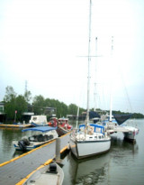
Tanjong City Marina based around the century-old Church Street Pier.
Tanjung City Marina is an abandoned marina off Weld Quay within George Town's UNESCO World Heritage Site. Built in the early 2000s by the Malaysian federal government to rejuvenate ...


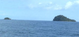


 Pulau Bunting is the northernmost in a row of islands off Yan District in Kedah. It is also the only one to be linked to the mainland by a bridge.
")