Pulau Raja is densely wooded and about 53m high. A yellowish sandstone rock, about 0.9m high, lies on a reef which extends about 0.2 mile NW from the W extremity of the island. The coast extending SE of Raja Bay is skirted by reefs and above-water rocks within 1 mile of the coast, ...
Pulau Keueh, an island 69m high, lies about 4 miles SE of Ujung Gla and 0.5 mile offshore. Its W side is steep-to, and may be approached closely, but the E and S sides have a coral reef 91m wide, with 11m close-to.
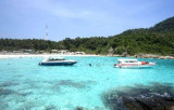
Raja Bay (Teluk Raya), entered between Ujung No and the N side of Pulau Raja, about 3 miles S, is one of the best anchorages on this coast; although it is open to the W, it has good holding ground, with depths of about 14.6m. The head of the bay is fringed by a coral reef which ...
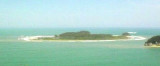
Pejaba Islands, about 4 miles SSE of Pulau Keueh, consists of two wooded islands, with a low,rocky, barren islet, nearly always covered by surf, lying about 0.1 mile SW of the outer island. A rock, nearly awash, lies 0.3 mile S of the inner island.
Ujung Glumpang is a precipitous tongue of land crowned by a green hill with a few scattered trees on it. A reef extends E from the point for about 0.1 mile and to a distance of 137m offshore. Foul ground extends about 0.3 mile S from Ujung Glumpang.
Cikem islands are located about 1,2 NM S of Ug Glumpang. The W island is steep-to on its seaward side.The islands are densely wooded and joined by a reef.Pulua-pulau Cikem is in a seismicly active area with most recent
activity being an earthquake in Simeulue on Wednesday 01st of ...


 Ujung Gla, about 4 miles S of Lho Kroeet, is a sparsely wooded rocky point with precipitous sides and an above-water rock close off its N side.