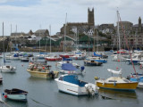

Mullion Cove
10nm
5°
8 Oct 15
Atb
| Latitude | Longitude | |
| DMS | --- | --- |
| DM | --- | --- |
| DD | --- | --- |

 The water separating the coast of England from that of France is known in the United Kingdom as the English Channel, and in France as La Manche.
The climate of the English Channel is controlled to a large extent by the series of cyclonic disturbances that usually move toward the E or NE, generally passing N of the British Isles. In such cases, the English Channel is under the influence of a mild and moist SW or WSW jet stream.
At other times, different conditions occur mainly when an anticyclone appears and develops over northern Europe. Winds from E may persist for several days and blow in the channel.
In winter, weather to the E is bitter cold and it is often accompanied by strong winds, but in summer there is usually fine weather. Winds are very variable. The term “predominant wind” is of little significance in this area.
The main features are the westerlies that occur from December to January and from July to August. During both these periods, more than 50 per cent of the winds are from SSW to NNW, often from SW more than NW.
Easterlies are from NE to E and occur most frequently from October to November and from February to June. The frequency is highest in May. Winds from SE are the least frequent.
February and November have the most uniform distribution of winds from all directions.
Winds are characterized as predominantly W over the Scilly Isles, unlike over the English Channel. There is a tendency for wind shifts from W to NW more so than from SW to W in summer, and to a lesser degree in January.
In the approaches to Southampton and the Isle of Wight, winds often blow along The Solent and Spithead. Local variations are usually subordinate to the main stream which may sweep over much of the Isle of Wight. The island has not been observed to provide its own sea breeze.
The main breeze reaches force 3 or 4 on the coast and more over the water, then spreads out over the land. The land breeze blows on clear nights throughout the year and may be more marked in winter than in summer.
At the Bill of Portland, the sea breeze effect results in a strong tendency for winds from N to NE to veer toward E, and those from W to NW to back toward SW between 0700 and 1300. The fluctuation of land and sea breeze at The Bill of Portland is sometimes NE to WSW, the general direction is parallel with the coast. The tendency is very pronounced during the warmer months and it is particularly marked for the N and S directions.
This is a land and sea breeze effect reinforced by the configuration of the river mouth. The effect is substantially repeated in similar topographical situations, in particular at Plymouth.
Ebook | Manche - English Channel
|