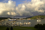
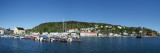
The Skagerrak is a strait running between Norway and the southwest coast of Sweden and the Jutland peninsula of Denmark, connecting the North Sea and the Kattegat sea area, which leads to the Baltic Sea. The S side of the Skagerrak extending between Hanstholm and Skagen, about 77 miles ENE, is generally low and backed by sand dunes. However, there are several areas where steep cliffs face the coast. The coastal passage leads ENE across the entrances of Vigo Bugt, Jammerbugt, and Tannis Bugt, three adjacent bights that indent the shore.
Hirtshals Lighthouse1 January 1863 Hirtshals lighted beacon, which had taken the entire 2.5 years to build. Construction of the lighthouse was the culmination of a plan from 1854 when it was decided first to move the Skagen lighthouse and partly to build a new lighthouse at Hirtshals. ...
The Gray LighthouseSkagenIn 1857-58 Skagen new lighthouse was built by architect N.S. Nebelong little further out towards the branch than the white lighthouse. The 46 meter tall lighthouse ia built on a formidable foundation consisting of 429 meter long piles stk.16 is struck ...


 The Skagerrak is a strait running between Norway and the southwest coast of Sweden and the Jutland peninsula of Denmark, connecting the North Sea and the Kattegat sea area, which leads to the Baltic Sea.