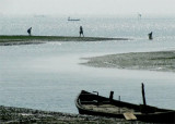
Hugli River Entrance (W Bengal-India)
4.5nm
292°
Caution ...
28 Apr 12
Jojo
| Latitude | Longitude | |
| DMS | --- | --- |
| DM | --- | --- |
| DD | --- | --- |

 Sagar Roads, the navigable entrance at the mouth of the Hugli River, lies about 2 miles W of the SW extremity of Sagar Island.
West current depending on force and duration of E winds; weather generally clear.
West and SW current; generally a gale or cyclonic storm.
Cessation of the strong tides of the Hugli River; fogs in January in morning.
Thick fogs in morning; floods strong in the Hugli River toward end of month.
Flood tide occasionally accompanied by bore; sometimes a gale or cyclonic storm in April or May.
In June, the “chota bursat” or small rain, generally lasts two weeks.
Freshets in the river, much swell in Eastern Channel.
Strong W current at the Sandheads.
Seaward of the Sundarbans, there are strong rotatory currents. During the rising tide, the tidal current commences by setting W and gradually turns through N to NE.
During the falling tide, it commences by setting E and gradually turns through S to SW.
At the Sandheads there is a strong W current in August; during September, after the cessation of the Southwest Monsoon, the W current depends on the force and duration of the E winds; in October, there is a W and SW current. During cyclonic weather, a strong W set of 2 to 5 knots is experienced.
During W gales, an E set of 1 to 2 knots develops.
Tides at the Sandheads and in Sagar Roads are semidiurnal.
Sagar Tidal Semaphore, displaying day and night signals, lies about 0.5 mile SSW of Sagar Island Light. Dublat Mark lies on Sidney Point, the SE extremity of Sagar Island.
In Eastern Channel, the tidal currents set, when not influenced by the wind here after:
The maximum velocities range from 2 to 3 knots at springs, and 1 to 1.5 knots during neaps, following the direction of the channel.
Eastern Sea Reef (21°14'N., 88°03'E.), with depths of 0.6 to 4.9m, has its S extremity about 29 miles S of Sagar Island Light. This reef extends S from Lower Long Sand, a drying shoal with its N end about 4.5 miles SSW of Sagar Island Light. A shoal, with depths of 0.6 to 4.9m, extends about 26 miles SSE from New Island (21°33'N., 88°11'E.). During the Southwest Monsoon, the sea breaks heavily over the S end of this shoal.
Middle Ground, with depths of 1.2 to 5.5m, lies between Western Sea Reef and Eastern Sea Reef. Depths over this shoal range from a drying patch on its N end to a depth of 5.2m over its S end. This shoal breaks heavily during the Southwest Monsoon.
Lower Gasper Light Vessel (21°21.9'N., 88°09.6'E.) has a red hull with one mast surmounted by a topmark.
A similar breaking shoal, with depths of 0.6 to 5.5m, lies between
Eastern Sea Reef and the previously-described shoal which extends SSE from New Island.
Eastern Channel, with Gasper Channel, its N extension, lies between Eastern Sea Reef and the shoal to the E which extends about 26 miles SSE from New Island. Sagar Roads is entered N of this latter channel. Both Gasper Channel and Sagar Roads are marked by lighted buoys. A number of dangerous wrecks, marked by buoys, are encountered at the junction of the two fairways.
Western Channel lies between Western Sea Reef and Eastern Sea Reef, and leads into Beaumont’s Gut, which leads into Sagar Roads.
Upper Long Sand (21°34'N., 87°57'E.), a drying bank about 5 miles long, lies with its upper end about 5.3 miles SW of Sagar Island Light. A narrow shoal, with depths of 1.8 to 4.6m, extends 10.5 miles S from Upper Long Sand and then curves NE to join the upper part of Eastern Sea Reef.
Mizen Sand, a small drying bank, lies about 2.3 miles N of Upper Long Sand; Tigris Sand lies about 1 mile farther N.
Lighted Buoy LWA is moored close off the NE end of Mizen Sand. Lighted Buoy AD is moored close off the E side of Tigris Sand, 2 miles NNW of Lighted Buoy LWA.
Auckland Bar (21°45'N., 87°59'E.) has depths of over 4.6m.
A passage from Auckland Bar to Haldia Port is made through Jellingham Channel, marked by lighted buoys.
In 1986, it was reported that sand banks and islands SW of Aguimari Char (22°00'N., 88°08'E.) were to have been washed away to form a crossing to run from Jellingham Channel to Rangafala Channel, lying E of Aguimari Char. This connecting channel will allow an alternate route to Kulpi Roads and Calcutta, a detour from Haldia Channel. In 1988, Rangafala Channel was marked by lighted buoys. In 1989, it was reported that vessels make passage through Rangafala Crossing SSW of Aguimari into Rangafala Channel.
Middleton Bar (21°36'N., 88°03'E.), which dries 1.2m near its S end, lies centered about 3.3 miles S of Sagar Island Light, on the W side of Gaspar Channel. North of Middleton Bar a narrow shoal, with depths of less than 3m, extends about 4 miles N to join the drying coastal flat about 2 miles N of Sagar Island Light. A drying bank lies on this shoal about 1.5 miles WSW of the same lighthouse.
Ebook | Bay of Bengal
|