Muara Harbor

Muara Harbor

Pour géolocaliser ce lieu. Mettre à jour si besoin.

Localisation

Muara Harbor
LatitudeLongitude
DMS------
DM------
DD------

Caractéristiques

Port
Eau
Gasoil
Secours
Chantier naval

Description

Port côtier.
2012/04/13
Mettre à jour
Steve Drew
Port.
2012/04/13
Mettre à jour
Steve Drew
Muara Harbor
2012-04-13
Mettre à jour
Steve Drew
Partagez vos remarques ou photos sur "Muara Harbor"

Sites autour de Muara Harbor

Flying distances - Direct line

Sutera Harbour (MY)

81nm
46°
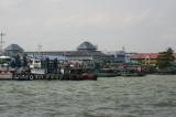
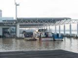
Enter your comments here.
Location
Provide details or delete
Entrance Navigation
The average dept at lowest astronomical tide (LAT) is 5 meters inside the basin and outside the breakwater is more than 7 metres.
Arrival Requirements
All visiting vessels are required ...
5 Nov 08

Mantanani Resort

126nm
36°
Mantanani is a group of 3 isolated islands (06-42.8N by 116-18.3E) northwest of Kota Belud, or about an hour drive from the state capital of Kota Kinabalu. Although only approximately an hour drive by speed boat from the mainland, the islands are a reminder of an earlier and simpler ...
7 Jan 08
Anonymous

Lahad Datu

194nm
90°
Petit port côtier.
13 Apr 12
julieteeee

Sibu

254nm
229°
Petit port .
13 Apr 12
AnarhieS