Gopnath Point, the W entrance point of the Gulf of Cambay, is moderately high, with a conspicuous light structure and bungalow on it. A temple, 23m high, lies near the coast, about 0.8 mile N of the point.A reef, which dries 2.7m, extends about 1.5 miles ENE from Gopnath Point.Gopnath ...
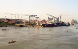
Pipavav Bandar, the principal port for Dongar, about 6 miles N, is the principal town on this part of the coast.Pipavav Bandar lies on the NW shore of the West Channel. It is an all season port offering container, bulk, break bulk and liquid cargo handling services. It imports and ...
Suvali Point, the E entrance point of the Gulf of Cambay, is fringed by the drying coastal reef which extends about 1 mile W of the point. Tapti Light is shown from a white circular stone column, 27m high, on the point; a tomb lies close SE of the light structure. The coast ...
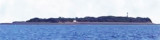
Piram Island, 11m high and composed of sand, lies with its N end about 2.8 miles SE of Kuda Point. At the S end of the island there are a few trees and a little cultivation; the NE side is fringed by a few mangrove trees. The lighthouse is conspicuous near the middle of the island; ...
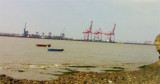
Magdalla, an official point of entry, includes the Hazira port complex comprised an Hazira Offshore Terminal, the Hazira LNG Terminal, and a bulk/container terminal presently under construction. The actual port of Magdalla is located about 5 miles upstream on the S bank of the ...
Dani Point Light is shown from a steel framework structure, 26m high, about 2.5 miles SE of the entrance to the Sena River. Gulwala Bank, with depths of less than 11m, extends about 6.3 miles S from a position about 3.5 miles W of the S entrance point of the Kim River. There is ...


 Kotada Bluff is 26m high and conspicuous.
")