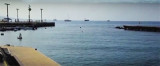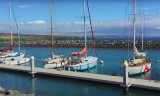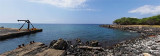

Honokohau harbor and marina (Hawaii I)
54nm
266°
Fax: (808) 327 3675262 b.
14 Dec 15
Joëlle
| Latitude | Longitude | |
| DMS | --- | --- |
| DM | --- | --- |
| DD | --- | --- |


")
Ebook | Hawaii
|
 Harbor protected by a breakwater. See www.matson.com/matnav/ports/hilo.html for a local map.
The State-owned and operated piers are on the E side of Kūhiō Bay. Transit sheds with 103,000 square feet of covered space, and 7.5 acres of open storage space are also available. Hilo has no facilities for drydocking or making repairs to deep-draft vessels, the nearest facilities are in Honolulu. A marine railway at Hilo has a capacity of 50 tons. Several machine, electrical, and welding shops off the waterfront are available for making above-waterline repairs to vessels at the port. [www.nauticalcharts.noaa.gov/nsd/coastpilot_w.php?book=7] Chapter 14
Pier 1: Berth length: 1,265'; draft: 35'; yard area: 13.4 acres; primary use: overseas containers and cruise ships. [http://hidot.hawaii.gov/harbors/files/2012/10/Hilo-Harbor-Hawaii.pdf]
1,255 feet of berthing space, 34 feet reported alongside; deck height, 9 feet. [www.nauticalcharts.noaa.gov/nsd/coastpilot_w.php?book=7] Chapter 14
Primary use: receipt and shipment of conventional-and-containerized general cargo and automobiles. Mooring U.S. Coast Guard vessel. State of Hawaii: A 466-foot-long concrete bulkhead east from rear of face (Radio Bay Wharf) moors small craft including pilot boat at small boathouse, with U.S. Coast Guard vessels at steel pile, timber-decked pier adjacent to boathouse. Tel: (808) 933-4778. Approximately 10 acres of open storage area including seventy refrigerated container positions is located at outer end of wharf, at rear of transit shed. Concrete bulkhead with solid fill at concrete pile, concrete-decked wharf with platform at inner end serving adjacent, company- owned Pier 2. Wharf is fronted by rubber-and-timber fender system. Year of Last Survey: 1998 Corps of Engineers Waterway Code: 84012 Dock Code: 964 Pacific Ocean Division.[http://seaport.findthebest.com/l/6625/State-of-Hawaii-Hilo-Pier-1]
[web.archive.org/web/20130224160400/www.ndc.iwr.usace.army.mil//ports/pdf/ps/ps50.pdf]
Pier 2: Berth
length: 703'; draft: 33'; yard area: 2.0 acres; primary use: inter-island
cargo.
[http://hidot.hawaii.gov/harbors/files/2012/10/Hilo-Harbor-Hawaii.pdf]
722 feet of berthing space, draft: 35 feet reported alongside; deck height, 10 feet; receipt and shipment of general and containerized cargo by barge; receipt of bulk cement and lumber. [www.nauticalcharts.noaa.gov/nsd/coastpilot_w.php?book=7] Chapter 14
Primary use: receipt and shipment of conventional and containerized general cargo and automobiles. Approximately 4 acres of paved storage area. Year of Last Survey: 1998 Corps of Engineers Waterway Code: 84012 Dock Code: 960 Pacific Ocean Division.
[http://seaport.findthebest.com/l/6624/State-of-Hawaii-Hilo-Pier-2]
[web.archive.org/web/20130224160400/www.ndc.iwr.usace.army.mil//ports/pdf/ps/ps50.pdf]
Pier 3: Berth length: 637'; draft: 33'; yard area: 7.3 acres; primary use: liquid-bulk cargo and pipelines, inter-island cargo. [http://hidot.hawaii.gov/harbors/files/2012/10/Hilo-Harbor-Hawaii.pdf]
636 feet of berthing space, draft: 35 feet reported alongside; deck height, 9½
feet; receipt of occasional cruise ships, petroleum products, liquefied
petroleum gas, and lumber; shipment of molasses; and occasional receipt and
shipment of general and containerized cargo by barge. [www.nauticalcharts.noaa.gov/nsd/coastpilot_w.php?book=7]
Chapter 14]
Operator State
of Hawaii, Department of Transportation, Harbors Division; and others. Tel: (808) 933-4778. Year of Last Survey: 1998 Corps of Engineers Waterway Code:
84012 Dock Code: 950 Pacific Ocean Division.
[http://seaport.findthebest.com/l/6623/State-of-Hawaii-Hilo-Pier-3]
[web.archive.org/web/20130224160400/www.ndc.iwr.usace.army.mil//ports/pdf/ps/ps50.pdf]
NOAA hydrographic charts may be found online at:
http://www.charts.noaa.gov/OnLineViewer/19324.shtml
http://geographic.org/nautical_charts/40_hawaiian_islands_and_us_territories/19324_1_hilo_bay.html
http://www.nauticalchartsonline.com/chart/zoom?chart=19324
http://www.oceangrafix.com/chart/detail/19324-Island-Of-Hawaii-Hilo-Bay
")