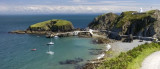
Lundy lies off the coast of North Devon, where the Atlantic ocean meets the Bristol Channel with nothing between it and America, a granite outcrop, three miles long and half a mile wide. In the hubbub of the modern world it is a place apart, peaceful and unspoiled.


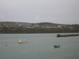


 Port protégé par une digue.
 Port protected by a breakwater.