Nawadu, about 5 miles NNE of Naguri, was populated in 1970.
There is an opening into the lagoon, about 4 miles wide, between Rufuri, a small islet, 0.5 mile N of Nawadu, and Maduni Faro, at the NW corner of the atoll.
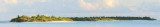
Maduni Faro, a lagoon reef, forms the NW extremity of the atoll. The islets of Marandu, Tukandu, and Miledu, the first two inhabited in 1970, lie, respectively, on the barrier reef between the N end of Maduni Faro and the islet of Gafuri, about 5 miles ESE. Gafuri ...
Kelai, at the NE extremity of the atoll, was inhabited in 1970. Good radar returns have been reported from Kelai at 14 miles. The islet of Tinadu lies about 3 miles WSW of Kelai.
Digufuri Reef (Digfurhi Reef), at the S end of Ihavandiffulu Atoll, has an islet at its E end; a small sandbank, with palms on it, lies about 0.8 mile ENE of the islet.
Naguri, an island with a circular lagoon reef, lies about 7 miles N of Muradu; two large reefs lie between these islands.A lighted beacon lies at the NW point of a reef, about 3.3 miles NW of Muradu.
Warifuri Faro is a large lagoon with the islet of Warifuri at its S end. A lighted beacon lies on the N side of Warifuri Faro. The islets of Dedu and Warifuri are inhabited; the islet of Noradu lies between the latter two islets.
Muradu lies on a circular reef near the W edge of the atoll; the latest maps prepared from aerial photography (1968) show that this island has joined the islet charted 0.8 mile W of it.Some rocky patches lie S and SE of Muradu.