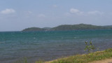
Kachchaitivu (Kachchtivu), about 10 miles SW of Delft Island , is 12m high and overed with scrub. There is a well and a small shrine on the NE side of the island.Depths of less than 9.1m extend 1 mile SE of the island. Depths of less than 5.5m extend about 2.5 mile NE from the ...
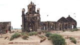
Lands End is the SE extremity of Pamban Island; a small but conspicuous building lies near the point. Dhanushkodi, about 2 miles NW of Lands End, is a railroad terminal; the red-roofed railway buildings are conspicuous.
Dhanushkodi, about 2 miles NW of Lands End, is connected to the railway system of India.A pier, for use by vessels of the ferry service between Dhanushkodi and Talaimannar, extends from the NE coast of Pamban Island abreast the town. The pier is 219m long, with depths of 3.4m on each ...