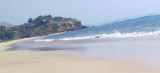
The coast between the entrances of the Savitri River and the Vashishti River, about 25 miles SSE, consists of a series of plateaus at elevations of 150 to 210m.
A vessel proceeding between the two rivers will not encounter any shoals by keeping from 1.5 to 3 miles offshore and in depths of over 9.1m.
Srivardhan Bay, about 5 miles SSE of Kumbaru Bay, is shallow and the village of Srivardhan lies at its head. A light is shown from the S end of the N entrance point of the bay fromSeptember to May.
Kumbaru Point, 70m high, lies about 3.5 miles S of Nanwell Point and is the N entrance point of Kumbaru Bay. The point fronts densely wooded hills rising to about 240m; there is a conspicuous bluff about 2.3miles E of the point. Shah Jehan Shoal, with a least depth of 4.2m, lies ...
Tolkeshwar Point, the S entrance point of the Vashisti River, is bold and faced with cliffs about 90m high; an ancient Hindu temple and a prominent clump of trees stand on its summit.
Korlai Fort, on the S side of Kundalika River entrance, stands on the summit of a reddish-colored headland, connected to the mainland by a low, narrow, and sandy isthmus. The N part of this headland slopes gradually to the sea and terminates in a rocky point. A light, with a racon, ...


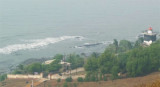
 The coast between the entrances of the Savitri River and the Vashishti River, about 25 miles SSE, consists of a series of plateaus at elevations of 150 to 210m.