Sacrifice Rock, 18m high and conspicuous, lies about 6.5 miles WNW of Kadalur Point. It consists of granite and, having a white appearance, can be seen 10 miles in clear weather. The passage between this rock and the coast is free of dangers, but vessels using it should keep near the rock, and not proceed into depths of less than 13m.
Vessels passing W of this rock at night should not proceed into depths of less than 27m which are found about 2.5 miles W of the rock.
A shoal, swept to a depth of 2.7m, lies almost 1 mile offshore W of Tikkotti village.
Kadalur Point, low but prominent, is covered with palm trees, over which will be seen a large round tree. Hills gradually rise NE of the point; the nearest summit is 78m high, about 1.3 miles NE of the point.The coastal reef extends about 1.5 miles W and 1.3 miles S from the point. ...
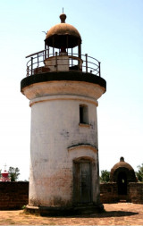
An ancient fort stands on rising ground near the coast. Tellicherry Light is shown from the NW bastion of the fort.Bilikulu, a natural breakwater of basalt, 6m high, lies parallel to the coast, about 0.5 mile SW of the fort.
Elattur Cape, about 4 miles farther SSE, is low and rocky, with coconut palms close inland. The mouth of the Elattur River, a shallow and rocky river, lies about 1.3 miles N of the cape.
The port of Calicut, also known as Kozhikode, is an open roadstead of considerable commercial importance. Cargo is worked at the anchorage by lighters. The port is unusable from the beginning of June to the end of August. Depths—LimitationsReliance Shoal, with a least depth of ...
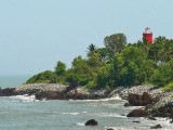
Cannanore Light is shown from a white, concrete column with red bands 1 mile WNW of Fort St. Angelo. A red conical buoy is moored about 0.5 mile SE of the fort from October to May and marks the approach to the inner anchorage for small craft. The coast between Cannanore and ...
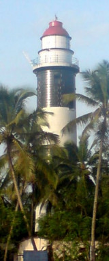
The port of Beypore (Beipur), an open roadstead, lies off the entrance of the Beypore River (10 Km south of Calicut) at and is considered a wharf of the port of Calicut (Kozhikode).New Beypore Light is shown from an octagonal masonry tower, with red and white bands, on the SE ...


 Sacrifice Rock, 18m high and conspicuous, lies about 6.5 miles WNW of Kadalur Point. It consists of granite and, having a white appearance, can be seen 10 miles in clear weather.