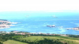
Cape Salvatore (Rt Savudrija) is bounded by some shoals dangerous to
navigation and highlighted by the lighthouse which is located at the south end of the promontory and consists of a white tower with a cupola gray.
2011/08/28
Update
Jojo
Cap Salvatore (Rt Savudrija) est bordé par certains hauts-fonds
dangereux pour la navigation et mis en évidence par le phare qui est
situé à l'extrémité au sud du promontoire et se compose d'une tour
blanche avec une coupole grise.
2011/08/28
Update
Jojo
Capo Salvore (Rt Savudrija) è orlato da alcune secche pericolose per la
navigazione ed evidenziato dal faro che si trova sulla punta meridionale
del promontorio ed è costituito da una torre bianca con cupola grigia.
Koperski Zaliv (Baia di Capodistria) is entered between Rt Ronco and Rt Debeli, 5 miles NE.The NE and SW shores of the bay are hilly, but the shore at the head of the bay, through which the Fiume Risano flows, is low. Monte Sermino, surrounded by salt beds, rises isolated in the river ...
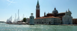
The Gulf of Piran or Piran Bay (Slovene: Piranski zaliv, Croatian: Piranski zaljev or Savudrijska vala, Italian: Baia di Pirano) is located in the northern part of the Adriatic Sea, and is a part of the Gulf of Trieste. It is between Rt Madona at N and Rt Saudrija. It was named ...
Warning: From Porec to the entrance to the Limski kanal there are a large number of dangerous shoals and rocks. On the N side of Funtana bay is the Janjci shoal, its northern edge is marked by a black post with two red bands and topped with two black spheres. At the southern ...
Limski Kana is entered between Rt Kriz, located 2.4 miles NW of Rovinj, and Rt Sjole, 1 mile NNW. The Lim bay and valley is a peculiar geographic feature found near Rovinj and Vrsar on the western coast of Istria, south of Porec, Croatia.The Lim valley is the 35 km long valley ...


 Cape Salvatore (Rt Savudrija) is bounded by some shoals dangerous to
navigation and highlighted by the lighthouse which is located at the south end of the promontory and consists of a white tower with a cupola gray.
Cape Salvatore (Rt Savudrija) is bounded by some shoals dangerous to
navigation and highlighted by the lighthouse which is located at the south end of the promontory and consists of a white tower with a cupola gray. Cap Salvatore (Rt Savudrija) est bordé par certains hauts-fonds
dangereux pour la navigation et mis en évidence par le phare qui est
situé à l'extrémité au sud du promontoire et se compose d'une tour
blanche avec une coupole grise.
Cap Salvatore (Rt Savudrija) est bordé par certains hauts-fonds
dangereux pour la navigation et mis en évidence par le phare qui est
situé à l'extrémité au sud du promontoire et se compose d'une tour
blanche avec une coupole grise. Capo Salvore (Rt Savudrija) è orlato da alcune secche pericolose per la
navigazione ed evidenziato dal faro che si trova sulla punta meridionale
del promontorio ed è costituito da una torre bianca con cupola grigia.
Capo Salvore (Rt Savudrija) è orlato da alcune secche pericolose per la
navigazione ed evidenziato dal faro che si trova sulla punta meridionale
del promontorio ed è costituito da una torre bianca con cupola grigia. Slovenia")