Pulau Raja is densely wooded and about 53m high. A yellowish sandstone rock, about 0.9m high, lies on a reef which extends about 0.2 mile NW from the W extremity of the island.
The coast extending SE of Raja Bay is skirted by reefs and above-water rocks within 1 mile of the coast, which are usually marked by swells.
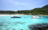
Raja Bay (Teluk Raya), entered between Ujung No and the N side of Pulau Raja, about 3 miles S, is one of the best anchorages on this coast; although it is open to the W, it has good holding ground, with depths of about 14.6m. The head of the bay is fringed by a coral reef which ...
Ujung Gla, about 4 miles S of Lho Kroeet, is a sparsely wooded rocky point with precipitous sides and an above-water rock close off its N side. The shore of the bay lying between Lho Kroeet and Ujung Gla consists of low, red-colored hills covered by coconut palms.
Pulau Keueh, an island 69m high, lies about 4 miles SE of Ujung Gla and 0.5 mile offshore. Its W side is steep-to, and may be approached closely, but the E and S sides have a coral reef 91m wide, with 11m close-to.
Pejaba Islands, about 4 miles SSE of Pulau Keueh, consists of two wooded islands, with a low,rocky, barren islet, nearly always covered by surf, lying about 0.1 mile SW of the outer island. A rock, nearly awash, lies 0.3 mile S of the inner island.
Pulau Nasi (Peunasoe or Aceh island), nearly joins the SE point of Pulau Breueh, being separated by Aroih Lam Puyang. The coast line is rocky in places with sandy beaches chiefly on the W side.
Ujung Glumpang is a precipitous tongue of land crowned by a green hill with a few scattered trees on it. A reef extends E from the point for about 0.1 mile and to a distance of 137m offshore. Foul ground extends about 0.3 mile S from Ujung Glumpang.


 Pulau Raja is densely wooded and about 53m high. A yellowish sandstone rock, about 0.9m high, lies on a reef which extends about 0.2 mile NW from the W extremity of the island.
")


