Pulau Langkawi (Malaysia)

Pulau Langkawi (Malaysia)

To precisely geolocate this site. Update if necessary.

Localisation

Pulau Langkawi (Malaysia)
LatitudeLongitude
DMS------
DM------
DD------

Characteristics

Island / Atoll

Description

Pulau Langkawi (Malaysia)
Pulau Langkawi (Malaisia)
2011-11-23
Update
Jojo
Ebook

Andaman sea

  • 178 sites
  • 164 photos
  • publication date: 7 Jul 2023
  • .pdf file size: 54 Mb
Pulau Langkawi,  officially known as Langkawi, the Jewel of Kedah is an archipelago of 104 islands in the strait of Malacca, some 30 km off the mainland coast of northwestern Malaysia.
The islands are a part of the state of Kedah, which is adjacent to the Thai border.

Langkawi means reddish brown eagle in colloquial Malay. The Malay word for eagle is helang - shortened is "lang". Kawi means the colour reddish brown.

The main island of Langkawi itself has a total of 32,000 hectares. The main island spans about 25 km from north to south and slightly more for east and west. The coastal areas consist of flat, alluvial plains punctuated with limestone ridges. Two-thirds of the island is dominated by forest-covered mountains, hills and natural vegetation.

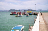
Only four of the 99 islands are inhabited - Pulau Langkawi (the main island), Pulau Tuba, Pulau Rebak and Pulau Dayang Bunting.

On langkawi island There are two island areas. The Southern Islands, with a heavy tourist population and the islands to the North East which are more secluded without tourist traffic.

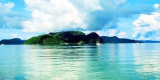
Pulau Langkawi, about 15 miles wide, is mountainous, densely wooded, and formed and flanked by towering masses of limestone.
The E coast of Pulau Langkawi is rocky, but there are a few sandy beaches.
A chain of islets lies SW of Pulau Chorong, the easternmost island of the group.
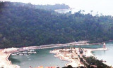
The W coast of Palau Langkawi S of Tanjung Chinchin to Tongung Belua, 4.5 miles S, is rocky and steep-to, with a few sandy beaches, backed by precipitous hills covered with jungle.
The bay SE of Tanjung Belua to Pulau Borau is fronted by a long sandy beach, backed by low lying land and small hills.

2011/11/25
Update
Jojo
Pulau Langkawi, officiellement connue sous Langkawi, le joyau de Kedah est un archipel de 104 îles dans le détroit de Malacca, à environ 30 km au large de la côte continentale du nord-ouest de Malaisie.

Les îles sont une partie de l'État de Kedah, qui est adjacente à la frontière thaïlandaise.
Langkawi signifie  aigle brun rougeâtre en  malais familier. Le mot malais pour aigle est helang - raccourcie: "lang". Kawi signifie la couleur brun rougeâtre.

L'île principale de Langkawi a elle-même un total de 32.000 hectares. L'île principale s'étend sur environ 25 km du nord au sud et un peu plus d'Orient et d'Occident. Les zones côtières se composent des plats, des plaines alluviales ponctué de crêtes calcaires. Deux-tiers de l'île est dominée par des montagnes couvertes de forêts, de collines et la végétation naturelle.

Seuls quatre des 99 îles sont habitées - Pulau Langkawi (l'île principale), Pulau Tuba, Pulau Rebak et Pulau Dayang Bunting.

Sur l'île de Langkawi Il ya deux zones insulaires. Les îles du sud, avec une population touristique lourds et les îles au Nord-Est qui sont plus isolées, sans trafic touristique.

Pulau Langkawi, à environ 15 miles de large, est montagneuse, boisée, et a formé et encadré par des masses imposantes de calcaire.
La côte E de Pulau Langkawi est rocheux, mais il ya quelques plages de sable fin.
Une chaîne d'îlots mensonges SW de Pulau Chorong, l'île la plus orientale du groupe.
La côte Ouest de Palau Langkawi S de Tanjung Chinchin à Tongung Belua, 4,5 miles S, est rocheuse et escarpée à, avec quelques plages de sable fin, soutenu par des collines escarpées couvertes de jungle.
Le SE baie de Tanjung Belua Pulau Borau est mené par une longue plage de sable, soutenu par la terre de faible altitude et de petites collines.
2011/12/13
Update
Jojo
Share your comments or photos on "Pulau Langkawi (Malaysia)"

Sites around Pulau Langkawi (Malaysia)

Flying distances - Direct line

Selat Cincin (Langkawi)

9.8nm
352°
Selat Cincin is the channel 4 miles wide between the S end of Ko Tarutao and the N coast of Pulau Langkawi.
The channel trends SE around the NE side of Pulau Langkawi and is bounded on the NE side by the coastal bank off the coast of Thailand.
Tides—Currents.—The tidal currents ...
25 Nov 11
Jojo

Pulau Dayang island (Langkawi)

7.3nm
182°
Pulau Dayang Bunting (Island Of The Pregnant Mermaid) is the second largest island of the Langkawi archipelago.
Located at a distance of about 17.6 km from Kuah Town, Pulau Dayang Bunting is accessible from Kuah Jetty or Pantai Cenang.Gua Langsir (Cave of the Banshee), located ...
26 Nov 11
Jojo

Pulau Tuba (Langkawi)

6.7nm
161°
Pulau Tuba (5 km S of Langkawi) is the only inhabited island besides the main island of Langkawi itself. This Langkawi island gets its name from the tuba roots. It is the only other island that offers accommodation and there are a few places to stay.
At Pulau Tuba, you can experience ...
27 Nov 11
Jojo

Pulau Timun (Langkawi)

6.5nm
110°
Located E coast of Malaysia.It's the most easterly anchorage for Langkawi. Being surrounded by a cluster of islands adds to the calm conditions  in most winds, but being close to the open sea, sometimes there's a
 bit of ground swell to contend with. The water is clean ...
27 Nov 11
Jojo

Pulau Singa Besar (Langkawi)

9.5nm
206°
Pulau Singa Besar is located about 17km from Kuah, nestled between the smaller island of Pulau Beras Basah to the west and Pulau Dayang Bunting to the east. The sedimentary rocks on this island are reputed to be among the oldest in Malaysia going back 500 million years.This island ...
27 Nov 11
Jojo

Bass harbour Kuah (langkawi)

2.4nm
133°
Bass Harbour is the main anchorage for Kuah Town, it is formed between the S coast of Pulau Langkawi and the N coast of Pulau Dayang Bunting, is 7 miles in length with an average breadth of 1.5 miles and a general depth of 5.5 to 7.5m, mud bottom..
The harbour has two main areas ...
14 Dec 11
Jojo