Porquerolles island is the most important island of the Isles d'Hyeres with its port on the NE side protected in the N by a jetty and in the W by a projection of rocks.
T. 04 94 58 30 72
Fax: 04 94 58 35 48
650 B. incl. 300 visit. (<30m)
Anchoring prohibited. Mooring on buoys reguted and limited to 12m max.
2012/03/24
Update
Max
Le port de Porquerolles, situé sur la côte NE, est protégé au N par une jetée et à l'W par une avancée de rochers.
T. 04 94 58 30 72
Fax: 04 94 58 35 48
650 pl. dont 300 visit. (<30m)
Mouillage interdit. Amarrage sur bouées règlementé et limité à 12m hors tout maxi.
Quelques places pour des unités de 20m à coté de la station de carburant.
2012/03/24
Update
Max
Le ponton d'accueil est déjà pas terrible : pas sûr de trouver quelque chose au bout de la pendille...Bien regarder les amarres avant des bateaux, certains en prennent deux, d'autres sur tribord et d'autres sur bâbord. En ce qui concerne l'hygiène des sanitaires il est préférable d'utiliser ceux de vos bateaux.
2015/06/23
Update
Roland Matras
Share your comments or photos on "Port de Porquerolles"
Ile de Porquerolles lies centered 3 miles SE of Ponte de l’Esterel. The summit of the island, located 1 mile from its E end, is 142m high and surmounted by a signal station.
Toulon is a large military harbour on the Mediterranean coast, with a major French naval base.The prevailing winds are from the NW (Mistral) and W. These winds may reach a velocity of Force 11. Winds from the E and SE, which are less frequent, are generally accompanied by rain squalls, ...
Golfe de Giens is entered between Pointe de Carqueiranne and Pointe Escampobariou, 4.7 miles SE. Pointe Escampobariou is the SW extremity of Presqu’ile de Giens, a peninsula, the W side of which is 118m high and surmounted by a tower. The E side of this gulf is bordered by ...
Prohibited areas, the limits of which are shown on the chart, lie SW of Pointe du Titan (Ile du Levant) and extend up to 2 miles from the coast. These areas, which are used by French naval vessels, are not in force between July 1 and August 31. Vessels are prohibited from approaching ...
The N coast of the island is low. It forms the harbor of Porquerolles which shelters a marina and the 3 biggest beaches of the island. Silver Beach in the west of the village, Courtade beach in the west and Notre Dame beach furthest from the small port of Porquerolles. The cape ...
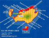
Ile de Port Cros, lies close E of Ile de Bagaud, is mainly wooded and is the highest island of the chain. Its summit, 207m high, is surmounted by a building, with two white cupolas, which are visible from a considerable distance. An islet, 63m high, lie 0.2 mile S of the S extremity ...


 canal 9
 à la supérette
 en hors saison, faible réserve.


 Porquerolles island is the most important island of the Isles d'Hyeres with its port on the NE side protected in the N by a jetty and in the W by a projection of rocks.
 Le port de Porquerolles, situé sur la côte NE, est protégé au N par une jetée et à l'W par une avancée de rochers.