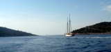
The island of Murter is the largest island of the Sibenik archipelago. It is close to the coast on which it is connected by a bridge, low air draft at Tijesno (Tisno) on the continent. During the summer the bridge opens to allow passage of boats. The NW part of the island is fertile and bears crops. The SE is characterized by limestone rocks. There are 4 tourist cities Betina Murter and Jezera and the NW and E Tisno.
2011/04/3
Update
Jojo
L'île de Murter est la plus grande des îles de l'archipel de Sibenik. Elle est proche de la côte à laquelle elle est reliée par un pont, de faible tirant d'air, à Tijesno (Tisno) sur le continent. Pendant la saison d'été ce pont s'ouvre pour permettre le passage des bateaux.
La partie NW de l'île est fertile et porte des cultures. Le SE est caractérisé par des rochers calcaires.
Il y a 4 villes touristiques: Betine et Murter au NW et Jezera et Tisno à l'E.
Otok Zirje
is the farthest and the largest island in the Sibenik archipelago. It is long of 6,5 NM (NW/SE) and 1,4 NM wide. The main village, Zirje, is located in the middle of the island. A small port, luka Muna, on the coast N of Zirje, home to the ferry that connects the ...
Vrgadski Kanal, 7 miles long, leads between Otok Murter and Otok Vrgada and is the principal channel used in the S approach to Pasmanski Kanal and Zadar. Vessels with a maximum draft of 6.4m may pass through Pasmanski Kanal. Vessels with drafts over 6.4m must either proceed through ...
Novigradsko More, a landlocked bay, lies at the S end of Novsko Zdrilo and provides good anchorage. Rijeka Zrmanja flows into the bay at the E side. This river is navigable by small craft as far as the village of Obrovca, 6 miles above the mouth. Luka Novigrad, a narrow inlet, ...
Kaprije is located in the central part of the Sibenik archipelago between the islands Zmajan and Kakan. The highlight of the island is Vela Glavica (132 m). The only village of the island is Kaprije, S. The port is busy. Automobiles are not allowed on the island.
Zlarinski Kanal leads along the SW side of Otok Zlarin and is entered midway between Rt Rat and Otocic Komorica, a small islet marked by a light, 1.5 miles SW. This channel is sometimes used as an alternate route to Sibenik by vessels entering Sibenska Vrata, the middle passage, ...
Otok Kakan, uninhabited, is at the W O. Kaprije. There is a nice anchorage on the E side, protected at the N by islands Borovnjak Veli and Borovnjak Mali.