Middle Island - Recherche Archopelago

Middle Island - Recherche Archopelago

To precisely geolocate this site. Update if necessary.

Localisation

Middle Island - Recherche Archopelago
LatitudeLongitude
DMS------
DM------
DD------

Characteristics

Island / Atoll

Description

Ebook

West Australia

  • 26 sites
  • 18 photos
  • publication date: 11 Jul 2023
  • .pdf file size: 8 Mb
Share your comments or photos on "Middle Island - Recherche Archopelago"

Sites around Middle Island - Recherche Archopelago

Flying distances - Direct line

Middle Island Recherche Archipelago

0.4nm
90°
The Middle Island in the Recherche Archipelago is most well known for its pink Lake Hillier that lies on its northern shore. It has a length of 6.5 kilometers and the highest elevation is at 185 meters.Along with the other islands next to it of the Recherche Archipelago, they ...
12 Oct 14
Horatius

Esperance

65nm
282°
Small port protected by a breakwater.
28 Aug 12
solanum

Albany

267nm
257°
Port.
5 Sep 12
andrew

Bunbury

379nm
277°
Port protected by a breakwater.
5 Sep 12

Mangles Bay

391nm
286°
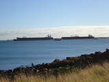
  Mangles Bay in Cockburn Sound is an increasingly popular mooring area for boat owners in the metropolitan region. In recent years the number of vessels moored in the bay has increased by in excess of 100 percent and there are now more than 500 registered moorings in the area.
The ...
20 Apr 09
anonymous