Localisation
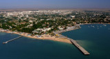
Mangalia
| Latitude | Longitude |
| DMS | --- | --- |
| DM | --- | --- |
| DD | --- | --- |
Description
Ebook | Black Sea + Sea of Azov- 35 sites
- 30 photos
- publication date: 6 Aug 2024
- .pdf file size: 31 Mb
|

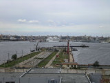
Small port protected by a breakwater. A safe place for leaving a ship a longer period of time. 24/7 security. Fair pricing

Petit port protégé par une digue.
Share your comments or photos on "Mangalia"
Sites around Mangalia
Flying distances - Direct line
Kavarna
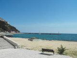
Kavarna is a small fishing harbour with a beach.Pomorie
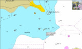
Water is shallow right outside the entry of the harbour. Dangerous underwater rocks. Go very close south of the Lighthouse or south-west of East buoy.