
Kanal Nove Povljane Vir
Shoals at the inner end of this channel restrict the fairway to a width of about 250m, with a controlling depth of 8m. Vessels with a draft of over 6m are advised not to ...
| Latitude | Longitude | |
| DMS | --- | --- |
| DM | --- | --- |
| DD | --- | --- |

 en ville
 station service
 centre médical, pharmacie
 marché
 en ville
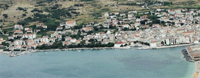
 Pag, administrative center of the island, founded in the 15th century and built in accordance with plans by
Approach: From the Velebitska Kanal, one enters Zaljev Paski, after rounding Nikolaon Rt Sv enters the port on the bottom, the S Paski Zaljev.
Dangers: Shoals at the W and S of the harbor, marked by two unlit buoys and two poles. The port extends to the east of the shoal. Beware of the tidal current which can sometimes reach 4 knots.
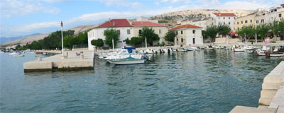
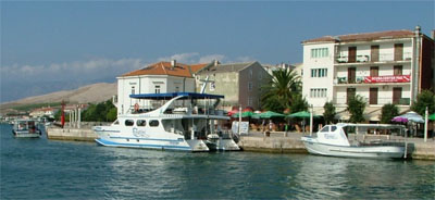
We moored along the quay of the river between the pelvis and the bridge by 3 m.
You can anchor the E or NE of the shoal to the proper depth.


 Pag, centre administratif de l'île, a été construite au XVème siècle et a gardé son aspect médiéval. Elle offre une multitude de monuments historiques tels que l'église St. Mary's sur la place centrale, la vieille tour, les remparts et le Palais Ducal. Beaucoup de reliques ecclésiastiques et les peintures se trouvent au Couvent bénédictin, qui a conservé l'antique tradition de la cuisson "baskotins», un pain croustillant et sec.
Approche: En venant du Velebitski Kanal, on entre dans Paski Zaljev, après avoir arrondi Rt Sv Nikolaon entre dans le port situé au fond, au S de Paski Zaljev.
Dangers: hauts-fonds à l'W et au S du port, signalés par deux bouées sans feu et deux perches. Le port s'étend à l'E de ce haut-fond. Attention au courant de marée qui peut parfois atteindre 4 n?uds.
On s'amarre le long du quai de la rivière, entre le petit bassin et le pont, par 3 m.
On peut mouiller à l'E ou au NE du haut-fond à la profondeur appropriée.

Ebook | Dalmacija (Dalmatie)
|
Ebook | Šibensko-kninska županija (Šibenik-Knin County)
|


