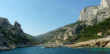
Rade de Toulon
10nm
94°
1 May 12
Muntza
| Latitude | Longitude | |
| DMS | --- | --- |
| DM | --- | --- |
| DD | --- | --- |

 The bay of La Ciotat affords poor holding ground on a bottom of mud and weed, and vessels are liable to drag during strong winds. Anchorage should be taken within 0.3 mile of the shore in order to get as much shelter as possible from the land and to avoid the steep slope of the bottom which occurs farther offshore. A good berth lies about 0.3 mile NE of the La Ciotat harbor entrance. Good anchorage is also available, in a depth of 14m, in Rade de Ceyreste, about 0.7 mile NE of the harbor entrance.
Baie de Bandol lies 3 miles SE of Pointe du Deffend and is entered between Ile de Bandol and Pointe de la Cride, 1 mile SSE.
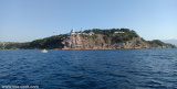
Ile de Bandol can be identified by its prominent reddish-colored rocks. It is connected to a peninsula close N by a bank which has depths of 0.2 to 2m. Chateau de Bandol stands on the outer end of the peninsula, which is 25m high and is conspicuous.
La Fourmigue, a rock, lies on a shoal about 0.2 mile E of the E extremity of Ile de Bandol. It is 1m high and marked by a beacon. Vessels should not attempt to pass between the beacon and the island.
A small yacht harbor, protected by two jetties, lies on the N side of Ile de Bandol at its E end.
Pointe de la Cride, the S entrance point of the bay, is low and pointed. An old battery stands on its extremity. A reef extends
SW from the point and is marked at its seaward end by a beacon.
Baie de Sanary affords good shelter against winds from the NW through NE to SE, but W or SW winds, if strong, send in a heavy sea.
 Entre le cap de l'Aigle qui pointe son bec vers le ciel et le
promontoire du cap Sicié, la côte provençale se creuse en un vaste plan
d'eau relativement abrité du mistral offrant 3 baies:
Entre le cap de l'Aigle qui pointe son bec vers le ciel et le
promontoire du cap Sicié, la côte provençale se creuse en un vaste plan
d'eau relativement abrité du mistral offrant 3 baies:- La Ciotat
- Bandol
- Sanary
Ebook | Côte d'Azur - French Riviera
|