The marina is situated on the Var Coast opposite the Golden Islands (Porquerolles) E of the Giens peninsula, between Toulon and St-Tropez, comprising 3 basins and providing shelter from all winds. Danger: deep swell in E wind.
1432 B. incl. 120 visit. (<16m)
2012/03/24
Update
Max
It has two captaincies located in the 1st and 3rd Basins.
2021/07/25
Update
azerty
Le port est bien abrité de tous les vents. Situés sur la côte varoise face aux îles d'Or, sur la côte E de la presqu'île de Giens, entre Toulon et St Tropez. Il comprend 3 bassins. Danger: forte houle par vent d'E.
T. 04 94 12 54 40
F. 04 94 12 54 50
1432 pl. dont 120 visit. (<16m)
Il dispose de deux capitaineries situées au 1er et au 3ème Bassins.
2012/03/24
Update
dd
Il porto è ben riparato da tutti i venti. Situato sulla costa del Var di fronte alle Isole d'Oro, sulla costa E della penisola di Giens, tra Tolone e St Tropez. Comprende 3 bacini. Pericolo: forte moto ondoso di vento di E.
2021/07/25
Update
azerty
Entrée Sud
Mouillage possible au SW de l'entrée. Bien regarder sur la carte, une zone triangulaire est interdite (Boue noire?).
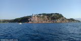
Ile de Porquerolles lies centered 3 miles SE of Ponte de l’Esterel. The summit of the island, located 1 mile from its E end, is 142m high and surmounted by a signal station.
Toulon is a large military harbour on the Mediterranean coast, with a major French naval base.The prevailing winds are from the NW (Mistral) and W. These winds may reach a velocity of Force 11. Winds from the E and SE, which are less frequent, are generally accompanied by rain squalls, ...
Golfe de Giens is entered between Pointe de Carqueiranne and Pointe Escampobariou, 4.7 miles SE. Pointe Escampobariou is the SW extremity of Presqu’ile de Giens, a peninsula, the W side of which is 118m high and surmounted by a tower. The E side of this gulf is bordered by ...
Prohibited areas, the limits of which are shown on the chart, lie SW of Pointe du Titan (Ile du Levant) and extend up to 2 miles from the coast. These areas, which are used by French naval vessels, are not in force between July 1 and August 31. Vessels are prohibited from approaching ...
The N coast of the island is low. It forms the harbor of Porquerolles which shelters a marina and the 3 biggest beaches of the island. Silver Beach in the west of the village, Courtade beach in the west and Notre Dame beach furthest from the small port of Porquerolles. The cape ...
Zone au sud de la rade de Toulon avec de belles anses ouvertes sur le large. En cas de Mistral, on peut mouiller à l'Est du Cap Sicié près des 2 frères.


 Canal 9


 The marina is situated on the Var Coast opposite the Golden Islands (Porquerolles) E of the Giens peninsula, between Toulon and St-Tropez, comprising 3 basins and providing shelter from all winds.
 Le port est bien abrité de tous les vents. Situés sur la côte varoise face aux îles d'Or, sur la côte E de la presqu'île de Giens, entre Toulon et St Tropez. Il comprend 3 bassins.
 Il porto è ben riparato da tutti i venti. Situato sulla costa del Var di fronte alle Isole d'Oro, sulla costa E della penisola di Giens, tra Tolone e St Tropez. Comprende 3 bacini.


 Entrée bassin du milieu.