Hramina marina

Hramina marina

To precisely geolocate this site. Update if necessary.

Localisation

Characteristics

Port
Water
Electricity
Fuel SE de la marina
First aid
Mechanical repair
Shipyard 15 T
Slip
Parking
Shower
Wifi
WC
Laundry
Market
Grocery
Bakery
Restaurant
Post
Bank

Description

Hramina marina
2011:08:12 15:35:43
2011-08-12
Update
Croatia
Ebook

Šibensko-kninska županija (Šibenik-Knin County)

  • 100 sites
  • 182 photos
  • publication date: 24 Jul 2024
  • .pdf file size: 63 Mb
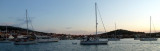
Uvala Hramina is well protected from any wind. You can anchor in the bay or join the marina. In the marina the access is a little bit narrow as the distance between pontoons.
2011/08/14
Update
Croatia
Hramina marina
Access to the marina.
2011:08:13 14:29:47
2011-08-14
Update
Croatia
Uvala Hramina est une grande baie bien protégée située au N de O. Murter.
Le village du même nom est situé sur la rive S de la baie et la marina Hramina se trouve à l'E. Les pêcheurs disposent d'un quai près du village au S de la baie.

L'accès à la baie passe entre Rt Gradina sur O. Murter à l'E et Otocic Tegina qui porte un feu à l'W.
Il y a 8 m de fond dans le chenal.

Les autres passages à l'W entre les îles, et entre les îles et O. Murter, ont peu de fond et sont parsemées de roches.

Attention il y a peu de place entre les pontons de la marina et cela rend les manœuvres difficiles.

Protection totale.

Tel: 022 434411
Fax: 435242
Mail: info@marina-hramina.hr

400 pl. (<50 m)
250 pl. à sec

2011/08/12
Update
Croatia
Ebook

Dalmacija (Dalmatie)

  • 563 sites
  • 942 photos
  • publication date: 26 Jul 2024
  • .pdf file size: 343 Mb
Share your comments or photos on "Hramina marina"

Sites around Hramina marina

Flying distances - Direct line

Otok Murter

2nm
147°
The island of Murter is the largest island of the Sibenik archipelago. It is close to the coast on which it is connected by a bridge, low air draft at Tijesno (Tisno) on the continent. During the summer the bridge opens to allow passage of boats.
The NW part of the island is fertile ...
3 Apr 11
Jojo

Otok Zirje (Sibenik)

11nm
160°
Otok Zirje is the farthest and the largest island in the Sibenik archipelago.
It is long of 6,5 NM (NW/SE) and 1,4 NM wide.
The main village, Zirje, is located in the middle of the island. A small port, luka Muna, on the coast N of Zirje, home to the ferry that connects the ...
16 Aug 11
Croatia

Vrgadski Kanal

3.1nm
302°
Vrgadski Kanal, 7 miles long, leads between Otok Murter and Otok Vrgada and is the principal channel used in the S approach to Pasmanski Kanal and Zadar.
Vessels with a maximum draft of 6.4m may pass through Pasmanski Kanal. Vessels with drafts over 6.4m must either proceed through ...
16 Jul 11
Jojo

Novigradsko More

22nm
354°
Novigradsko More, a landlocked bay, lies at the S end of Novsko Zdrilo and provides good anchorage.
Rijeka Zrmanja flows into the bay at the E side. This river is navigable by small craft as far as the village of Obrovca, 6 miles above the mouth.
Luka Novigrad, a narrow inlet, ...
23 Jul 11
Jojo

Otok Kaprije (Sibenik)

9.1nm
149°
Kaprije is located in the central part of the Sibenik archipelago between the islands Zmajan and Kakan.
The highlight of the island is Vela Glavica (132 m).
The only village of the island is Kaprije, S. The port is busy.
Automobiles are not allowed on the island.
16 Aug 11
Croatia

Uvala Hramina Murter

0.1nm
211°
We can anchor in 4 m, at SW of the bay, in the bottom.Good shelter from any wind. Place recommended in case of bad weather.
14 Aug 11
Croatia