Sea-Seek
Fishing bay
english
français
italiano
español
Nautical Ebooks
Toolbox
Navigation
Create a port, anchorage, an area
About Sea-Seek
Admin
Anchorages / Marinas
Toolbox
Navigation
Fishing bay
To precisely geolocate this site. Update if necessary.
Localisation
NW Atlantic Ocean
US - East coast
Chesapeake Bay
Fishing bay
Latitude
Longitude
DMS
---
---
DM
---
---
DD
---
---
Characteristics
Description
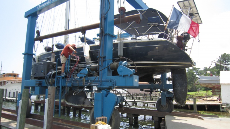
Fishing bay est un excellent mouillage par 5 mètres de fond. Il est possible de mettre le bateau au sec à Chesapeake boat works marina à un prix particulièrement intéressant.
2011/09/11
Update
Ebook
US - East coast
US - East coast
190 sites
66 photos
publication date: 4 Aug 2024
.pdf file size: 142 Mb
2011:07:05 12:42:07
2011-09-11
Update
Share your comments or photos on
"Fishing bay"
Sites around
Fishing bay
Flying distances - Direct line
Windmill Point Marina Entrance
4.8nm
25°
10 Dec 24
Anonymous
R Casciello
10nm
179°
10 Dec 24
Anonymous
Hook Wine and Sinker
13nm
299°
10 Dec 24
Anonymous
Cape Charles Harbor
22nm
137°
Small port.
27 Apr 11
Anonymous
Newport News
34nm
187°
Harbor.
28 Apr 11
Anonymous
Norfolk
40nm
178°
Large harbor.
28 Apr 11
Anonymous
Sea-Seek
Sailing Guide
During your navigation, remember to update the data.
If a harbor, marina or anchorage is missing, create it.
Thank you for all boaters.