The Sungai Muar, a shallow river available only to small craft, discharges into the strait about 14 miles ESE of Pulau Besar. The river is tortuous but small craft with drafts of 1.8m can ascend to Kepong Hill about 60 NM above the entrance. A radio mast stands on the E bank of ...
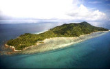
Karimun Kecil or Little Karimun, separated from the NE side of Great Karimun by a deep channel about 0.5 mile wide, is a bold island, 377m high. In the NW approach to the channel between Great Karimun and Little Karimun are two islets, Nangoi, 39m high, about 1.2 miles W of the ...
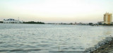
Between Melaka and Tanjong Seginting, about 46 miles SE, the low, thickly wooded coast is bordered by a mud bank which extends up to 2.5 miles offshore in places. The Water Islands, centered about 8 miles SE of Melaka, consists of a group of six tree-covered islands of moderate ...
Raffles Marina offers 158 walk-on wet berths catering for boats up to 20m, or 65 ft in length. The marina?s solid panel breakwater provides the calmest marina lagoon in Singapore, with an average lagoon depth of 4 metres at LAT. Features Single or Double Berths ...