China sea

China sea

To precisely geolocate this site. Update if necessary.

Localisation

China sea
LatitudeLongitude
DMS------
DM------
DD------

Characteristics

Coast

Description

fangcheng china vessel navios ulysses
2014/03/9
Update
ludy
Share your comments or photos on "China sea"

Sites around China sea

Flying distances - Direct line

Taiwan

101nm
176°
Hualien Port 
26 May 14
Sailor Stephen

Penghu County

126nm
214°
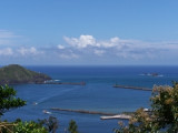
The Penghu islands,  also known as Pescadores from the Portuguese, meaning "fishermen".Sino-French War
The Penghu archipelago was captured by the French in March 1885, in the closing weeks of the Sino-French War, and evacuated four months later. The Pescadores Campaign was ...
11 Feb 10
Anonymous

Zhuwei

25nm
102°
1 Jan 70
Anonymous

Tan-shui

32nm
95°
Small port .
2 Mar 13
articledate

Chi-lung

52nm
93°
Large harbor protected by a breakwater.
2 Mar 13
libraries

Su-ao

70nm
121°
Harbor protected by a breakwater.
2 Mar 13