Celukan Bawang

Celukan Bawang

To precisely geolocate this site. Update if necessary.

Localisation

Celukan Bawang
LatitudeLongitude
DMS------
DM------
DD------

Characteristics

Port
Water
Fuel
First aid
Shipyard

Description

Port.
2012/03/27
Update
DD
Port côtier.
2012/03/27
Update
DD
Share your comments or photos on "Celukan Bawang"

Sites around Celukan Bawang

Flying distances - Direct line

Bali, Tulamben

47nm
98°
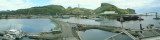
Tulamben is located on the NE Coast of Bali and famous becasue of its WW II US LIBERTY shipwreck, which rests around 25m on sandy bottom. It was torpedoed by a Japanese sub, but did not sink. She was pulled to the beach where she laid till 1962 Gunung Agung, the highest volcano on ...
11 Feb 12
Jojo

Sanur

39nm
139°
1 Jan 70
Anonymous

Surabaya

138nm
295°
Harbor protected by a breakwater.
27 Mar 12

Stagen

304nm
14°
Small port.
13 Apr 12
ThaBigBadWong