Localisation
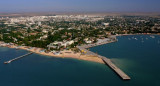
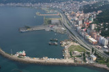
Batumi
Latitude Longitude DMS --- --- DM --- --- DD --- ---
Description
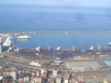
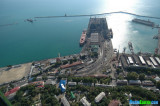
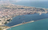
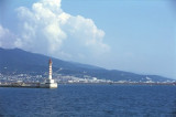
Port protected by a breakwater.
2011/12/18
Update
Tarentella
Port protégé par une digue.
2011/12/18
Update
Tarentella
2011-12-18
Update
Tarentella
Ebook
Black Sea + Sea of Azov 35 sites 30 photos publication date: 6 Aug 2024 .pdf file size: 31 Mb
Share your comments or photos on "Batumi"
Sites around BatumiFlying distances - Direct line
Rize
Trabzon
Giresun
Tuapse
Samsun Liman
Sea-Seek Sailing Guide During your navigation, remember to update the data. If a harbor, marina or anchorage is missing, create it. Thank you for all boaters.


 Port protected by a breakwater.
 Port protégé par une digue.