Sombrero Channel separates the central and S groups of the Nicobar Islands. The channel is 30 miles wide between Cape Albany and Sombrero Point, the N extremity of Little Nicobar Island. The depths in the channel are irregular, but there is deep water in mid-channel.Strong tidal currents set through this channel.
A yellow clay patch, with a depth of 21.9m, lies in the W approach to Sombrero Channel about 12 miles WSW of Cape Albany.
Shoal patches may exist in this area.
A detached coral bank, with a least depth of 17.1m, extends up to 12 miles SSW of Cape Albany. Depths elsewhere on this bank range from 20.1 to 31.1m. This bank has been reported to be extending to the W.
Nancowry Island lies close S of and overlaps the S end of Camorta Island. Nancowry Harbor, a secure landlocked inlet, lies between them. The E entrance of Nancowry Harbor lies between the SE end of Camorta Island and the NE end of Nancowry Island. The approach to this entrance leads ...
Trinkat Island, which lies between 1.5 and 2.5 miles E of the S part of Camorta Island, is separated from that island to the W and NW by False Bay and Beresford Channel. Trinkat Island is low, level, and covered by coconut trees. An extensive reef surrounds the island. Morrel Point, ...
Trak Island lies 5 miles WNW of Sombrero Point; Treis Island lies 1 mile SE of Trak Island. Both islands are small, reef-fringed, and surrounded by sunken rocks. A rock, which has a depth of less than 1.8m, lies about midway between Treis Island and Sombrero Point.
Miroe Island, low and small, lies 10.5 miles WNW of Sombrero Point, the N extremity of Little Nicobar Island. Miroe Island has been reported to be a good radar target up to 19 miles.
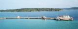
Cross Harbor is entered from the W between Alfred and Leda Points and from the E between Naval and Mayo Points. Depths in the harbor area range from 21.9 to 53.1m, mud.
Beresford Channel is entered from the S through False Bay. Both shores are fronted by reefs and shoals that extend almost 0.8 mile offshore. A number of shoals, with depths of 5.5 to 11m, lie in the middle of the S part of the channel. The channel on both sides of Middle Reef, ...


 Sombrero Channel separates the central and S groups of the Nicobar Islands. The channel is 30 miles wide between Cape Albany and Sombrero Point, the N extremity of Little Nicobar Island.