Cebaco island (Panama)
54nm
252°
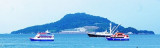
The only transportation to the island is by boat, but no commercial ferry operations are available. Local fisherman can be found on the mainland that are able to transport groups ...
27 Dec 15
Joëlle
| Latitude | Longitude | |
| DMS | --- | --- |
| DM | --- | --- |
| DD | --- | --- |

 Panama is the southernmost country of Central America. Situated on an
isthmus, some categorize it as a transcontinental nation connecting the
north and south part of America. It borders Costa Rica to the
north-west, Colombia to the south-east, the Caribbean Sea to the north
and the Pacific Ocean to the south.
Panama is the southernmost country of Central America. Situated on an
isthmus, some categorize it as a transcontinental nation connecting the
north and south part of America. It borders Costa Rica to the
north-west, Colombia to the south-east, the Caribbean Sea to the north
and the Pacific Ocean to the south.The country of Panama is dominated by the Panama Canal and the surrounding Panama Canal Area, which were incorporated fully into Panama on 31 December 1999.Balboa on the Pacific and Cristobal in the Caribbean are the two main ports and gateways to the Panama Canal.
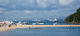
On the Pacific side of Panama, the Las Perlas islands are an unspoilt cruising ground popular with boats en route to the Galapagos and South Pacific islands. Like in other isolated parts of the world, sailors are advised to only stop in a remote anchorage in the company of another boat.
Although the Balboa Yacht Club received a new concession from the Panama Canal Commission and built a new clubhouse, the buildings of the Panama Yacht Club at Colon were demolished.
From the 1st February 2010 all persons or companies offering maritime services to ships or yachts in Panama must be in possession of an "Operation Licence". Cruisers are advised to check that anyone offering them such services has a valid licence, but should be aware that this provides no guarantee of the quality of the service being offered.
If you are entering the Bay of Panama from Costa Rica, go straight to the Perlas Islands and come up on the current. It is a longer distance but much quicker than trying to sail against the current. The shorter route from Punta Mala to Panama or Vacamonte is shorter, but the very strong current makes it a hard long sail.