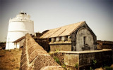
Redi Point is a flat rocky projection, 15m high at its W end. Redi Rock (Rairi Rock), 11m high, lies about 1 mile S of the point, at the S end of foul ground extending W and SSW of the point. Redi Fort (Rairi Fort), with an elevation of 34m, stands about 1 mile NE of Redi Point.
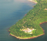
St George’s Islands consists of three islands between 1.5 and 2.5 miles SSW of Marmagao Head. Grandi Island is the collective name of the two S islands of the group, which are connected by a narrow reef of rock and shingle. The W of the two islands, 76m high and conical, is ...
Kura Islet, 9m high and the largest of three rocks, lies in the center of a group of rocks, about 1.3 miles NW of the entrance of Kalavali Creek. A 10.5m patch lies about 2 miles NNW of Kura Islet and about 1.5 miles offshore.A 5m patch lies about 0.7 mile S of Kura Islet.
Aguada Bay, entered between Aguada and Kabo Rajniwas, about 1.8 miles SSE, affords anchorage to moderate-sized vessels during the Northeast Monsoon. The bay is free from dangers, but strong W winds produce a heavy swell.Panaji, the capital and seat of government of the State of ...
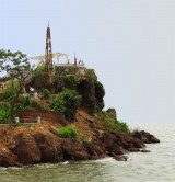
Cabo point, at the W extremity of the island of Goa, is a prominent headland, 55m high. A conspicuous church spire is situated near the seaward end of the headland.
Marmagao Head, about 61m high, is a tableland peninsula with steep sides, especially W. It is connected to the mainland SE by a narrow neck of low ground. A conspicuous water tower, with an elevation of 74m, is situated about 0.5 mile SE of Marmagao Point. North Head Breakwater ...