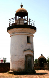
Sacrifice Rock (W India)
6.3nm
280°
The passage between this rock and the coast is free of dangers, but vessels using it should keep near ...
16 Mar 12
Jojo
| Latitude | Longitude | |
| DMS | --- | --- |
| DM | --- | --- |
| DD | --- | --- |

")
Ebook | Arabian Sea
|
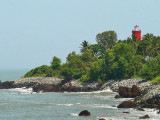
 Kadalur Point, low but prominent, is covered with palm trees, over which will be seen a large round tree. Hills gradually rise NE of the point; the nearest summit is 78m high, about 1.3 miles NE of the point.
The coastal reef extends about 1.5 miles W and 1.3 miles S from the point. Trikodi Reef, with a least depth of 1.5m and Kadalur Reef, with a least depth of 3.4m, are the W and SW ends, respectively, of the coastal reef.
The coast between Kadalur Point and Calicut (Kozhikode), about 14.5 miles SSE, is generally low, sandy, and fringed with palms. Red laterite hills back the coast.
Quilandi, a large village, lies about 3.8 miles ESE of Kadalur Point. A water tower is conspicuous on the coast, close S of the village.
The conspicuous summit of Palkunnu, 297m high, rises about 7.5 miles ESE of the village. A large black rock, with a tree on it, lies on the coast about 2.8 miles SSE of Quilandi.