Tillanchang Dwip (India)

Tillanchang Dwip (India)

Pour géolocaliser ce lieu. Mettre à jour si besoin.

Localisation

Tillanchang Dwip (India)
LatitudeLongitude
DMS------
DM------
DD------

Caractéristiques

Île / Atoll

Description

Tillanchang Dwip lies about 34 NM E of Chaowra island. Maharani peak, the highest of several peaks forming a jagged ridge along the length of the island, lies in the center of the island and attains elevation of 244 m.

Tillanchang  is an uninhabited island and has been declared a sanctuary by the Government of India. There is thick vegetation on the island. On the coast, coconut palms have been planted by the islanders from Chowra and Teressa who visit the island quite often. The island is infested by non poisonous snakes.

Paira Rock, 86m high, lies 0.5 mile NNW of Cape Maud, the N extremity of the island. Several detached rocks lie up to 1 mile off the W side of the island. Paria Rock has been reported to be a good radar target up to 19 miles.

Isle of Man, a detached rock, 111m high, lies about 2.8 miles SE of Cape Winifred. A chain of needle-like rocks lie between this rock and the cape.
An unexamined detached shoal, with a least depth of 20.1m, lies about 9.5 miles SW of Cape Winifred.

2011/11/29
Mettre à jour
Jojo
Ebook

Andaman sea

  • 177 sites
  • 162 photos
  • publication date: 8 Aug 2024
  • .pdf file size: 58 Mb
Partagez vos remarques ou photos sur "Tillanchang Dwip (India)"

Sites autour de Tillanchang Dwip (India)

Flying distances - Direct line

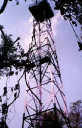
Nancowry island (India)

30nm
189°
Nancowry Island lies close S of and overlaps the S end of Camorta Island. Nancowry Harbor, a secure landlocked inlet, lies between them. The E entrance of Nancowry Harbor lies between the SE end of Camorta Island and the NE end of Nancowry Island. The approach to this entrance leads ...
29 Nov 11
Jojo

Chowra island (India)

34nm
267°
Chowra Island, which lies about 24 miles SSE of Batti Malv Island, is generally low but rises to a 104.5m high rocky pinnacle at its S end.
The island looks like a hat from the offing. Sanenya, the principal village, lies on the NE coast.
It has area of 8.2 sq km with a population ...
28 Nov 11
Jojo

Trinkat island Nicobar (India)

24nm
186°
Trinkat Island, which lies between 1.5 and 2.5 miles E of the S part of Camorta Island, is separated from that island to the W and NW by False Bay and Beresford Channel.
Trinkat Island is low, level, and covered by coconut trees. An extensive reef surrounds the island. Morrel Point, ...
30 Nov 11
Jojo

Castle Bay (Tillanchang)

1nm
184°
Castle Bay, which lies on the SE coast of the island about 2 miles N of Cape Winifred, is deep and clear in its central part.
A rock, awash, lies about 0.3 mile S of Castle Bay Point, the N entrance point of the bay. Foul ground, with depths of less than 9.1m, extends about 0.2 ...
29 Nov 11
Jojo

Tillanchang Dwip lighthouse

1.4nm
199°
Tillanchang is 15 km long and about 1 km in wide Island and lies on the Eastern periphery of Indian waters. It is the Eastern most island in the Nicobar Group of islands.
The 30 m high GI trestle tower was erected expeditiously and the 300 mm equipment with electronic flasher, ...
29 Nov 11
Jojo

Bompoka island (India)

27nm
238°
Bompoka island lies about 1,8 NM east from southern end of nearby Teressa Island in the Nicobar group of islands. The hills on the island rise upto 193 m. The island has dense forest and some portions have grass growth. There is thick coconut palm growth on shores all round ...
29 Nov 11
Jojo