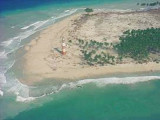
The North Sentinel Island is a 72 sq km island on the east of the Andaman Islands. It is inhabited by the Sentinelese, one of the last uncontacted tribes and the island's shores are protected for 3 km.
Sawai Bay indents the NW coast, between Keating Point and Hog Point, about 3.5 miles to SW. Foul ground extends 1 mile N from Keating Point and 0.5 mile N from Hog Point. Sawai Village lies 0.5 mile SE of Hog Point. The tidal currents off Sawai Bay set NE on the flood tide.An ...
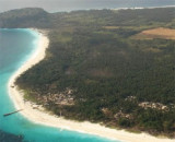
Chowra Island, which lies about 24 miles SSE of Batti Malv Island, is generally low but rises to a 104.5m high rocky pinnacle at its S end. The island looks like a hat from the offing. Sanenya, the principal village, lies on the NE coast. It has area of 8.2 sq km with a population ...
Batti Malv Island (or Kuono), which lies about 17 miles SSE of Car Nicobar, appears wedge-shaped from the offing. It's an uninhabited island that covers an area of 2 square kilometers. This very small island rises to a densely wooded peak about 73m high. The NW end of the island is ...


 The North Sentinel Island is a 72 sq km island on the east of the Andaman Islands. It is inhabited by the Sentinelese, one of the last uncontacted tribes and the island's shores are protected for 3 km.