
Azhikal port (W India)
8.6nm
119°
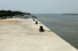
Presently the port has only one wharf, 50m in length, that can accomodate one vessel up to ...
15 Mar 12
Jojo
| Latitude | Longitude | |
| DMS | --- | --- |
| DM | --- | --- |
| DD | --- | --- |


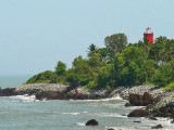
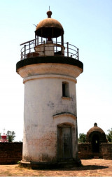
 Kotte Kunnu, a bluff point 52m high, at the SW extremity of a headland, is joined to the more elevated land by a low neck; a fort lies on Kotte Kunnu. Mount Dill Light (Kotte Kunna Light) is shown from a white triangular stone tower with red bands on the bluff point.
A stranded wreck lies 2 miles NNW; a dangerous wreck lies 3 miles SSE from Mount Dill Light.
The coast from Mount Dill to Cannanore, about 13 miles SE, is sandy and fringed with coconut palms. The Valapattanam River, marked on the N side of its entrance by a clump of casuarina trees, flows into the sea about 7 miles SE of Mount Dill. The bar at the entrance to the river has a least depth of 1.2m, and is subject to seasonal change.
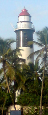
Azhikal Light is shown at the S side of the entrance. Storm signals are displayed near the light.
 point (W India)")
Ebook | Arabian Sea
|