Paarden Baai - (oranjestad)
51nm
79°
3 May 11
Anonymous
| Latitude | Longitude | |
| DMS | --- | --- |
| DM | --- | --- |
| DD | --- | --- |


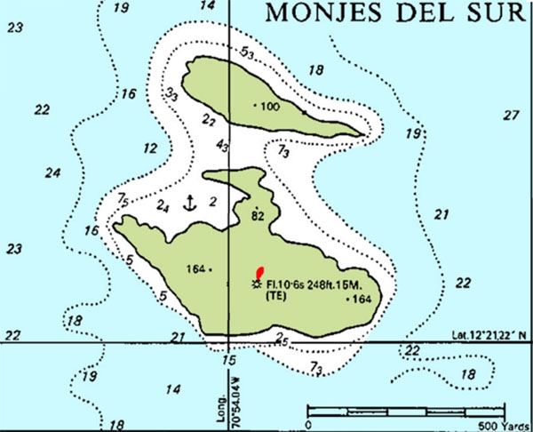
 The anchorage (12°21.45'N,
70°54.18'W) is on the southwest side of Isla Monje del
Sur. You moor to a two-inch polyester line attached to the
sides of an artificially created bay with room for five or
six boats. Unless you are absolutely certain the wind will
stay north or east, it is wise to drop a stern anchor in 50
feet of water to prevent your boat winding up on the shore
side of the big polyester line (as happened to us). The
young Venezuelan soldiers who come to your boat to write
down your information are stationed there for three-week
stints, are polite and will gratefully accept an offer of
cold juice or soda. There is no charge for the mooring. An
easy hike to the top of the rock provides a great view.


