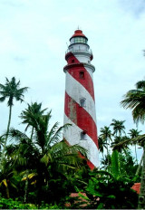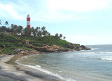

Kovalam Point (W India)
5.8nm
145°
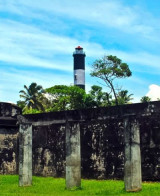
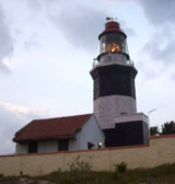
Good radar returns have been reported from the point at 19 miles.
KovalamBeach is probably the best known surf spot in India.
19 Mar 12
JoÃÂÃÂÃÂÃÂÃÂÃÂÃÂÃÂÃÂÃÂÃÂÃÂ
| Latitude | Longitude | |
| DMS | --- | --- |
| DM | --- | --- |
| DD | --- | --- |

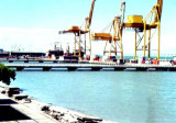
 Trivandrum (Thiruvananthapuram), the capital city of the state of Kerala, lies about 1 mile from the coast. The ruins of a pier, extending to the LW line, are prominent on the coast S of the city.
Trivandrum is a lighterage port with no docking facilities available.
Pilotage is not compulsory but one is available.
Trivandrum is closed during the Summer Monsoon season, usually May through August.
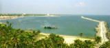
Landing should not be attempted by small boats due to a strong surf running along the coastline during the winter monsoon season.
Tel: 91-471-324533
Fax: 91-471-324842
Mail: portsdir@asianet.in
")
")
Ebook | Arabian Sea
|