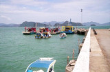
The Sungai Kedah, the river entrance which is about 20 miles S of Kuala Perlis, is shallow. The N entrance point of the Sungai Kedah is marked by a light.
There is an outer anchorage, in about 7m, 3 miles off the Sungai Kedah entrance.
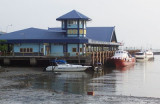
Alor Setar (Alor Star, the capital of Kedah State, is situated approximately 7 miles above the mouth of the Sungai Kedah. A ferry wharf, 55m in length with a depth of 1.2m alongside, is situated at Alor Setar.
There are no deep-water berthing facilities reported in this port.
From the Sungai Kedah the coast, with an adjoining mud flat, extends in a S direction for a distance of about 26 miles to the entrance of the Sungai Merbok (Merbau River), and continues low and wooded until within 8 or 9 miles of that river, where the conspicuous Gunong Jerai, 1,212m high, is located at a distance of 4 miles from the coast, in position 5°47'N, 100°26'E.
Caution.—In passing between the Sungai Kedah and Pulau Pinang (Penang Island) during the night, care must be taken to keep clear of the numerous fishing stakes which are fixed in places on the banks, some 6 or 7 miles from the coast.
2011/12/20
Actualizar
Jojo
Comparta sus comentarios o fotos en "The Sungai Kedah river (Malaysia)"
Sitios alrededor de The Sungai Kedah river (Malaysia)
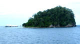
Pulau Paya lies 6.5 miles E from Pulau Segantang, 88m high, is densely wooded and steepto, except for part of the NE side. The Pulau Paya Marine Park has been established and special regulations may apply. Pulau Lembu, 73m high, lies 0.5 mile NE of Pulau Paya. A rock awash lies ...
Pulau Bunting is the northernmost in a row of islands off Yan District in Kedah. It is also the only one to be linked to the mainland by a bridge. The Pulau Bunting Bridge, or Jambatan Pulau Bunting connects it to the mainland Kedah.
Pulau Tuba (5 km S of Langkawi) is the only inhabited island besides the main island of Langkawi itself. This Langkawi island gets its name from the tuba roots.
It is the only other island that offers accommodation and there are a few places to stay. At Pulau Tuba, you can experience ...
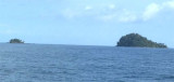
Pulau Segantang, consisting of two rocky islets, 25m high, lies about 22 miles W of the Sungai Kedah and 10 miles SE from the S extremity of Pulau Dayang Bunting. There are depths of 29.3m close to its N and E sides and 34.7m about 2 miles SW. A Marine Park, with a radius of ...
Located E coast of Malaysia.It's the most easterly anchorage for Langkawi. Being surrounded by a cluster of islands adds to the calm conditions in most winds, but being close to the open sea, sometimes there's a
bit of ground swell to contend with. The water is clean ...
Paknam Satul (Pak Nam Satun) lies about 10 miles NE of Pulau Langkawi and is well sheltered by the islands from the Southwest Monsoon. The port town of Kuala Perlis (Sungai Perils) lies about 7 miles SSE of Paknam Satul; coasting vessels anchor off it, in 5.5m, SW of a group of ...


 The Sungai Kedah, the river entrance which is about 20 miles S of Kuala Perlis, is shallow.
")
") Sungai Kedah lighthouse
Sungai Kedah lighthouse