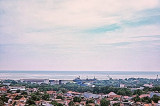
Tulamben is located on the NE Coast of Bali and famous becasue of its WW II US LIBERTY shipwreck, which rests around 25m on sandy bottom. It was torpedoed by a Japanese sub, but did not sink. She was pulled to the beach where she laid till 1962 Gunung Agung, the highest volcano on ...


 Port de commerce protégé par une digue.
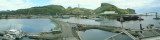
 Harbor protected by a breakwater.