Golfe du Saint-Laurent Le golfe comprend plusieurs larges îles, dont l'île d'Anticosti, l'île du Prince-Édouard et les îles de la Madeleine. L'île Saint-Paul, au large de l'île du Cap-Breton, est surnommée le cimetière du golfe, en souvenir des nombreux naufrages qui s'y sont produits. L'île Bonaventure près de la Gaspésie ainsi que l'île Brion et les "rochers aux oiseaux" au nord-est des îles de la Madeleine sont d'importants refuges d'oiseaux migrateurs entretenus par le service canadien de la faune.
2010/02/20
Actualizar
Joëlle
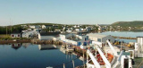
Gulf of Saint Lawrence, the world's largest estuary, is the outlet of North America's Great Lakes via the Saint Lawrence River into the Atlantic Ocean. The river flows into the gulf through the Jacques Cartier Strait between the Côte-Nord region of Quebec and the north shore of Anticosti Island, and the Honguedo Strait between the south shore of Anticosti Island and the Gaspé Peninsula. The gulf is bounded on the north by the Labrador Peninsula, to the east by Newfoundland, to the south by the Nova Scotia peninsula and Cape Breton Island, and to the west by the Gaspé and New Brunswick. It contains Anticosti Island, Prince Edward Island, and the Magdalen Islands.


 Golfe du Saint-Laurent
 Gulf of Saint Lawrence, the world's largest estuary, is the outlet of North America's Great Lakes via the Saint Lawrence River into the Atlantic Ocean.