
Rama cape (W India)
2.5nm
203°
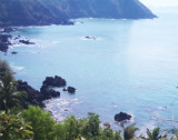
There are a number of river estuaries and it is often bordered by tableland in the middle of its S part.The Western Ghats, which are generally from 609 to ...
4 Mar 12
Jojo
| Latitude | Longitude | |
| DMS | --- | --- |
| DM | --- | --- |
| DD | --- | --- |


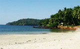
 Canaguinim Bay is entered between Canaguinim Point, about 1 mile SW of Betul Point, and Moliem Point, about 2 miles SW.
Two rock patches, each drying 1.2m, lie about 0.1mile and 0.3 mile, respectively, SW of Canaguinim Point.
")
Ebook | Arabian Sea
|