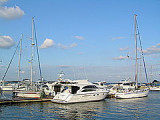
Obolon Ukraine
2.1nm
185°
7 Jul 26
Anonymous
| Latitude | Longitude | |
| DMS | --- | --- |
| DM | --- | --- |
| DD | --- | --- |

 Il mare Adriatico è una parte del Mar Mediterraneo, Golfo di molto tempo chiuso a nord. Confina a nord e ad ovest con l'Italia e ad est della penisola balcanica.
 Esso definisce tradizionalmente la sua estremità meridionale allo "Stretto di Otranto", dove le coste della Puglia e Albania sono i più vicini.
L'isola di Corfù è generalmente considerata come la strategia chiave di questo mare. Si trovano molti grandi porti, come Venezia (Mestre) e Trieste, che è stato a lungo l'uscita del impero austro-ungarico fino al Mar Mediterraneo.
Il mare adriatico è lungo circa 800 km e largo mediamente 150 km, ricoprendo una superficie di 132.000 km². La profondità non supera i 300 m nella parte settentrionale e raggiunge i 1222 m più a sud, lungo la direttrice da Bari alle bocche di Cattaro.
L'ampiezza di marea è abbastanza contenuta (circa 30 cm al sud e non oltre i 90 nell'estremità settentrionali): ciò ha permesso sin dall'antichità la fondazione, lungo la bassa costa settentrionale, di centri abitati come Aquileia, Chioggia, Grado, Venezia, famosa in tutto il mondo per il fenomeno dell'acqua alta che periodicamente ne sommerge di qualche decina di centimetri molte aree, e Ravenna.

 La mer Adriatique est une partie de la mer Méditerranée, sorte de golfe très allongé fermé vers le nord. Elle est encadrée au nord et à l'ouest par l'Italie et à l'est par la péninsule balkanique.
L'île de Corfou est généralement considérée comme la clé stratégique de cette mer. Plusieurs ports importants y sont situés, et notamment Venise (Mestre) et Trieste qui fut longtemps le débouché de l'empire austro-hongrois vers la mer Méditerranée.
La mer Adriatique est longue d'environ 800km et large d'environ 150 km, ce qui représente une superficie de 132 000 km². Sa profondeur n'est pas supérieure à 300 m dans sa partie Nord et approche les 1222 m plus au Sud, le long de la route De Bari aux Bouches du Kotor.
L'amplitude des marées est très faible (environ 30 cm vers le S et pas plus de 90 cm à l'extrémité N): ce qui a permis, depuis les temps anciens, la création, le long de la basse côte N, de villes comme Aquilée, Chioggia, Grado, Venise, mondialement connues pour le phénomène des hautes eaux qui, périodiquement, sont augmentées de quelques dizaines de centimètres dans de nombreux endroits dont Ravenne.
 The Adriatic Sea is a body of water separating the Italian Peninsula from the Balkan peninsula, and is a part of the Mediterranean Sea. The western coast is Italian, while the eastern coast runs mostly along Croatia, but lesser parts belong to Slovenia, Bosnia and Herzegovina, Montenegro, and Albania.
The island of Corfu is generally regarded as the key strategy of this sea where many major ports are located, including Venice (Mestre) and Trieste, which was long the outlet of the Austro-Hungarian Empire to the Mediterranean Sea.
The Adriatic Sea is about 800km long and about 150 km wide, which represents an area of 132,000 sq. km. Its depth is not greater than 300 m in the north, and approach the 1222 m further south along the road From the Mouths of Kotor Bari.
The tidal range is very low (about 30 cm towards the S and not more than 90 cm at the N) which has, since ancient times, the creation, along the low N side, cities such as Aquileia, Chioggia, Grado, Venice, world famous for the high water phenomenon that periodically are increased by a few feet in many places including Ravenna.